Wellington Crescent Riverbank, Path, and Roadway Project
Share Wellington Crescent Riverbank, Path, and Roadway Project on FacebookShare Wellington Crescent Riverbank, Path, and Roadway Project on TwitterShare Wellington Crescent Riverbank, Path, and Roadway Project on LinkedinEmail Wellington Crescent Riverbank, Path, and Roadway Project link
Public engagement is closed.
Introduction
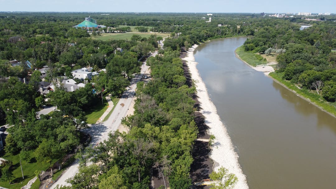
The City of Winnipeg (the City) investigated how best to protect City infrastructure and preserve the south bank of the Assiniboine River on Wellington Crescent between Assiniboine Park and Doncaster Street. Stabilizing the bank is necessary to protect underground utilities and the nearby path and road from further riverbank failure.
Various options to manage riverbank related risks were evaluated to determine the best approach for protecting City assets and amenities.
Background
In the summer of 2016, cracks appeared in the walk bike path along Wellington Crescent near Lamont Boulevard. The City was monitoring the area and found that the cracking was caused by riverbank movement. The riverbank movement continued to worsen, and in July 2017 the riverbank failed. The walk bike path was closed for safety reasons and a temporary gravel detour was built along the north curb of Wellington Crescent. The riverbank monitoring also identified potential risks to the path and street at other locations within the project area.
In September 2018, the City began investigating solutions for the project area. The Wellington Crescent Riverbank, Path, and Roadway Project seeks to:
Protect the streets, paths, lighting and underground utilities from the impacts of ongoing erosion and movement by stabilizing the riverbank or relocating infrastructure out of high risk zones
Preserve the riverbank with erosion protection and stability improvements along the south bank of the Assiniboine River
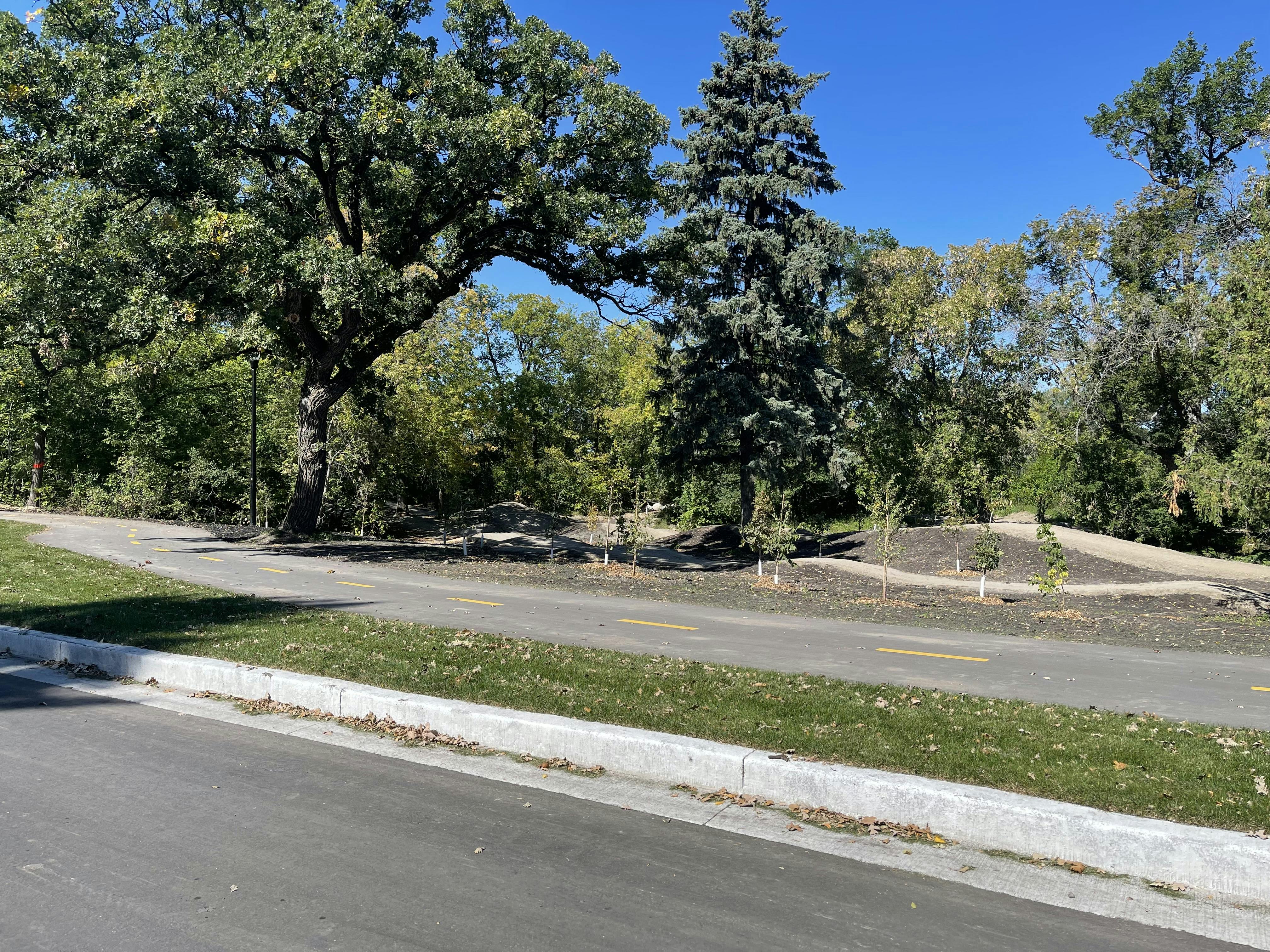
Restore the damaged walk bike path or construct a new paved path in a different location along Wellington Crescent
Introduction
The City of Winnipeg (the City) investigated how best to protect City infrastructure and preserve the south bank of the Assiniboine River on Wellington Crescent between Assiniboine Park and Doncaster Street. Stabilizing the bank is necessary to protect underground utilities and the nearby path and road from further riverbank failure.
Various options to manage riverbank related risks were evaluated to determine the best approach for protecting City assets and amenities.
Background
In the summer of 2016, cracks appeared in the walk bike path along Wellington Crescent near Lamont Boulevard. The City was monitoring the area and found that the cracking was caused by riverbank movement. The riverbank movement continued to worsen, and in July 2017 the riverbank failed. The walk bike path was closed for safety reasons and a temporary gravel detour was built along the north curb of Wellington Crescent. The riverbank monitoring also identified potential risks to the path and street at other locations within the project area.
In September 2018, the City began investigating solutions for the project area. The Wellington Crescent Riverbank, Path, and Roadway Project seeks to:
Protect the streets, paths, lighting and underground utilities from the impacts of ongoing erosion and movement by stabilizing the riverbank or relocating infrastructure out of high risk zones
Preserve the riverbank with erosion protection and stability improvements along the south bank of the Assiniboine River
Restore the damaged walk bike path or construct a new paved path in a different location along Wellington Crescent
CLOSED: This poll has concluded. The poll was open from June 2, 2020 to July 19, 2020.
Share What aspects of the project interest you the most? on FacebookShare What aspects of the project interest you the most? on TwitterShare What aspects of the project interest you the most? on LinkedinEmail What aspects of the project interest you the most? link
What aspects of the project interest you the most?
Visit winnipeg.ca/publicengagement to learn about some of the ways we can accommodate those who may need alternative access to engagement or information.
For inquiries or those who require alternate formats, interpretation or any additional accommodations to participate please contact winnipeg.ca/311 or 311.
Timeline
Project launch
Wellington Crescent Riverbank, Path, and Roadway Project has finished this stage
August 2018
Site investigation & functional design
Wellington Crescent Riverbank, Path, and Roadway Project has finished this stage
Collect data and evaluate options
August 2018 - March 2019
Property owner meeting
Wellington Crescent Riverbank, Path, and Roadway Project has finished this stage
April 2019
Traffic study
Wellington Crescent Riverbank, Path, and Roadway Project has finished this stage
Fall 2019 - spring 2020
Property owner meeting
Wellington Crescent Riverbank, Path, and Roadway Project has finished this stage
June 2020
Preliminary design
Wellington Crescent Riverbank, Path, and Roadway Project has finished this stage
Summer 2020
Public engagement
Wellington Crescent Riverbank, Path, and Roadway Project has finished this stage
June to July 2020
Detailed design
Wellington Crescent Riverbank, Path, and Roadway Project has finished this stage
Fall 2020
Construction begins
Wellington Crescent Riverbank, Path, and Roadway Project is currently at this stage