• Skip to main content
  • Jump to navigation
  • Search

IE10 and below are not supported.

Google Chrome Mozilla Firefox

Contact us for any help on browser support

Français

You are here:

  • Home
  • Airport Area West Water and Wastewater Study

Photos

Aniticpated Land Use Map
previous next
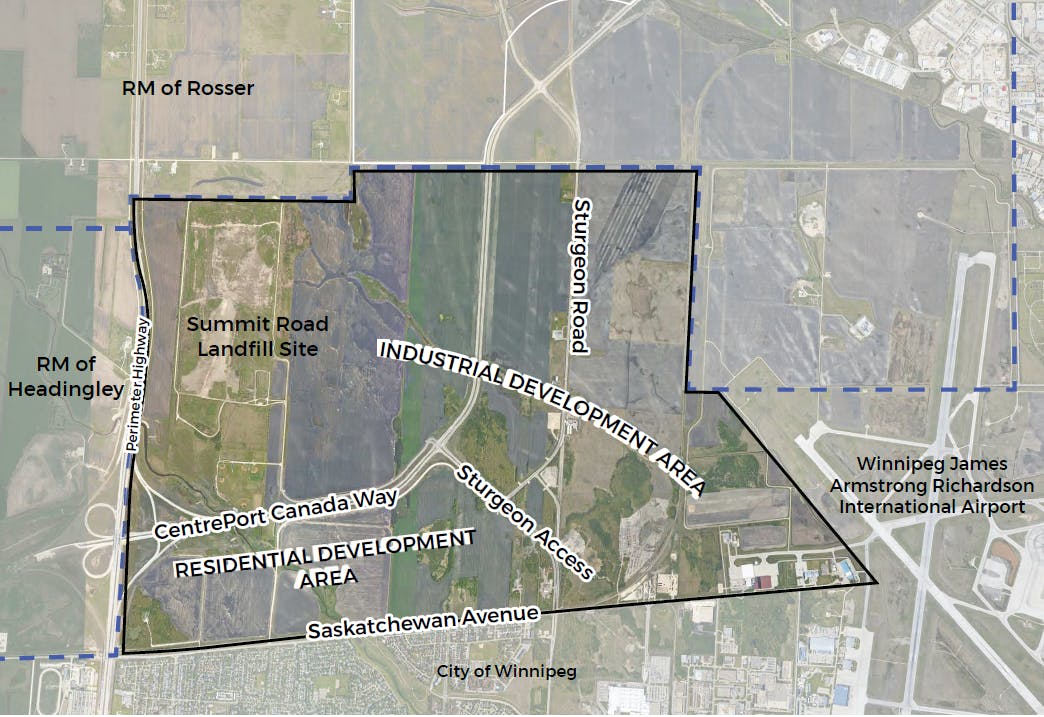
The City is currently reviewing a draft secondary plan (land use plan) for the residential area and another for the industrial area. It is anticipated that the residential lands will be developed as a lower-density residential neighbourhood with a small portion dedicated for mixed-use, higher-density residential development. It is anticipated that the remaining lands will be developed for industrial use, with commercial development nodes identified at key locations.
Study Area Map
Aniticpated Land Use Map
Conceptual Regional Water Infrastructure
Conceptual Water Servicing Infrastructure
Conceptual Regional Wastewater Infrastructure
Conceptual Wastewater Servicing Infrastructure