Point Douglas Neighbourhood Plan

Help us create a neighbourhood plan for Point Douglas.
Together, let’s create a vision for the long-term future of the neighbourhood. The Point Douglas Neighbourhood Plan will help guide future land use and development in the area.
The neighbourhood plan will include rules about where new buildings can be built and what they should look like. It will ensure that:
- A variety of housing exists for a wide range of people
- New housing is compatible with the existing houses
- Parks and other amenities are within walking distance of residents
- Point Douglas continues to develop as a walkable, bikeable, and transit-oriented community
We are developing a neighbourhood plan, also known as a secondary plan, to guide future development in Point Douglas.
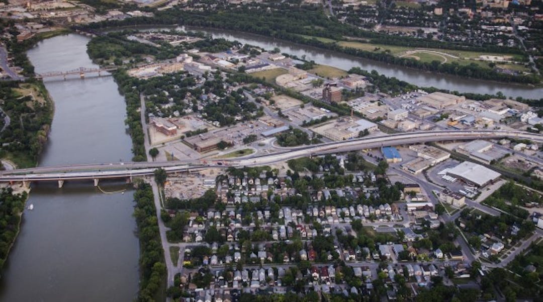
Point Douglas Neighbourhood Plan Area
The Point Douglas Neighbourhood Plan includes both North and South Point Douglas. The plan area is bounded by:
- Redwood Avenue to the north;
- The Red River to the east;
- The Canadian Pacific (CP) rail line and the Red River to the south; and
- Main Street to the west (excluding the lands that front directly along Main Street).
Purpose of the neighbourhood plan
The Point Douglas Neighbourhood Plan will help guide future land use and development in the area. It will ensure that:
The goal is to build upon the strengths and assets already present in Point Douglas. At the same time, it aims to encourage redevelopment and attract investment to the area where it makes sense. For example, the plan will consider ways to add new amenities to Point Douglas while preserving existing features like its canopy of mature trees.
What's included in the plan?
The neighbourhood plan will include rules about where new buildings can be built and what they should look like. It will identify:
Guiding policy framework
Planning policy forms a hierarchy. The Neighbourhood Plan, also known as a secondary plan, must conform with higher level planning policies such as OurWinnipeg 2045. All future development applications will need to conform with the Neighbourhood Plan.
OurWinnipeg 2045 policy areas
OurWinnipeg 2045 designates land into policy areas. Two designations apply to the Neighbourhood Plan Area:
- Mature Community
- Major Redevelopment Site
Major Redevelopment Sites cannot be rezoned to allow other land uses without a neighbourhood plan.
Current land use
Most land uses in North Point Douglas are residential, with some commercial. There are also many institutional uses (e.g. schools, churches), parks, and greenspaces. In South Point Douglas, most land uses are industrial.
Transportation and connectivity
There are four arterial streets (e.g. Sutherland Avenue) bordering or crossing Point Douglas, and two key collector streets (e.g. Euclid Avenue). Arterial streets carry large volumes of traffic between areas of the City. Collector streets collect and move traffic between arterial and residential streets.
Point Douglas is a central community, and has lots of pedestrians and cyclists. However, better conditions are needed for pedestrian and cyclists.
In 2021, Council approved the Eastern Rapid Transit Corridor route along Sutherland Avenue through Point Douglas, across a new Louise Bridge, and along Nairn Avenue and Regent Avenue.
Future land uses
We want to encourage growth in Point Douglas while:
- Supporting diverse housing needs
- Building on the neighborhood’s existing character
- Attracting new businesses and amenities
The Eastern Corridor Study informs future bus rapid transit in Point Douglas. This map is based on the land uses presented in the Eastern Corridor Study. It is a starting point for considering future land uses in Point Douglas.
Building from work that's been done
We’re not starting the Point Douglas Neighbourhood Plan from scratch. A lot of planning work and studies have been conducted in the neighbourhood in recent years. These plans were completed by the City and other groups.
We acknowledge that community leaders, stakeholders, and the public have contributed their knowledge, insights, and time to each of these projects.
We will not re-do the same work already done. We will build on the important the work done as a starting point for this project.
We will engage with Point Douglas residents, community leaders, landowners, housing providers, and area stakeholders to create a vision for the long-term future of the neighbourhood.
Stay Informed! Subscribe for project updates.
Subscribe
How can we help?
If you have questions or require alternate formats or accessibility accommodations to participate, please visit engage.winnipeg.ca/help or contact:
pointdouglasplan@winnipeg.ca | |
204-986-0537 |
Timeline
-
Project begins
Point Douglas Neighbourhood Plan has finished this stageWinter 2024
-
Background research and analysis
Point Douglas Neighbourhood Plan has finished this stageSpring 2024
-
Phase 1 public and stakeholder engagement
Point Douglas Neighbourhood Plan has finished this stageSummer to fall 2024
-
Prepare draft neighbourhood plan
Point Douglas Neighbourhood Plan is currently at this stageFall 2024 to winter 2025
-
Phase 2 public and stakeholder engagement
this is an upcoming stage for Point Douglas Neighbourhood PlanSpring 2025
-
Refine neighbourhood plan
this is an upcoming stage for Point Douglas Neighbourhood PlanSpring to summer 2025
-
Council consideration as a secondary plan bylaw
this is an upcoming stage for Point Douglas Neighbourhood PlanFall 2025
Who's listening
Engagement type
![]() | Involve Ensure your input is heard to help us define early options. |