Airport Area West Water and Wastewater Study
Share Airport Area West Water and Wastewater Study on Facebook
Share Airport Area West Water and Wastewater Study on X (formerly Twitter)
Share Airport Area West Water and Wastewater Study on Linkedin
Email Airport Area West Water and Wastewater Study link
Consultation has concluded

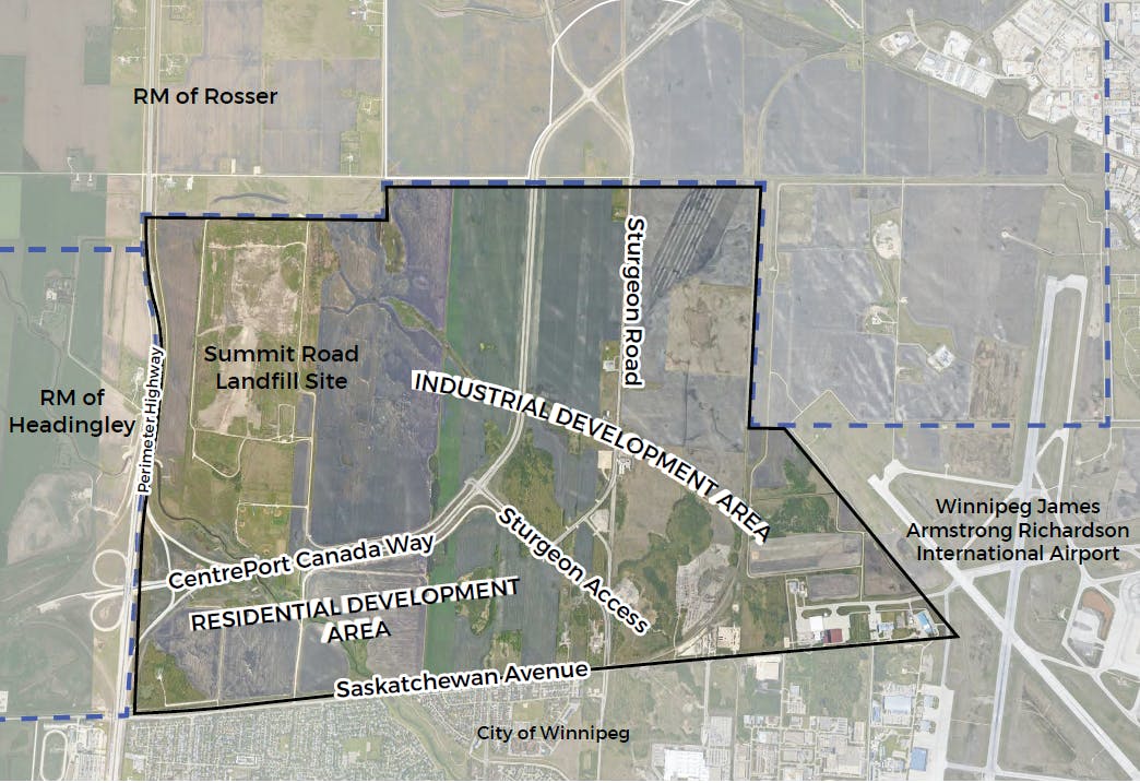
The purpose of this study is to develop a plan and cost estimate for regional water and sewer infrastructure for use in future planning in the area west of the airport. Information about the cost of water and sewer infrastructure will support the future decisions around growth and development of this unserviced area.
The study area boundaries include the Rural Municipality (RM) of Rosser to the north, the Winnipeg James Armstrong Richardson International Airport to the east, Saskatchewan Avenue to the south, and the Perimeter Highway to the west.
Consultation has concluded
Photos
Document Library
-
 Preliminary Design Report - May 2021 (102 MB) (pdf)
-
Preliminary Design Report Executive Summary - May 2021 (489 KB) (pdf)
-
Project Study Area Map - August 2020 (203 KB) (pdf)
-
Anticipated Land Use Map - August 2020 (220 KB) (pdf)
-
Presentation Boards - August 2020 (6.81 MB) (pdf)
-
Stakeholder Engagement Summary - September 2020 (85.1 KB) (pdf)
-
Stakeholder Engagement Summary Appendices - September 2020 (21.8 MB) (pdf)

Type of Engagement

Inform
Get information or updates.